

The agricultural community is becoming increasingly aware of the environmental and cost-saving benefits of precision farming.
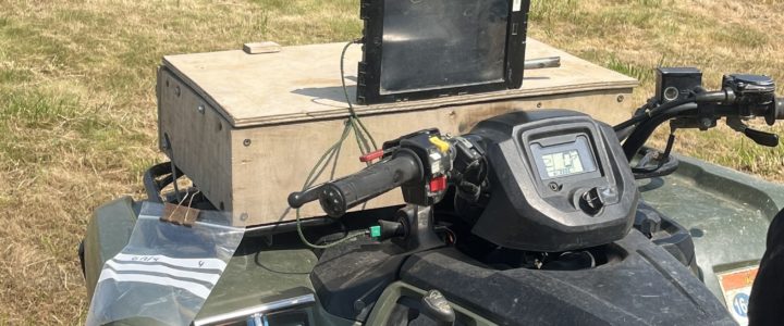
C A Agriculture Ltd is delighted to be in association with SOYL, national specialists offering a GPS mapping service using hi-tech units installed on our all-terrain vehicles. It is suitable for any farming system and is completely flexible.
Satellite technology is used to pinpoint precisely every location from where we take a core sample. Digitally-produced coloured maps provide a detailed coloured image of the fluctuation of pH and nutrient levels across your field.
That helps zone your land into hectares so you can prepare bespoke quantities and mixtures of nutrients. It helps to get the land conditioned exactly as you need it for your next crop – and saves costly wastage. With phosphate prices having gone through the roof in recent years, you’ll be only too aware that blanket spreading is no longer a cost-effective application option.
For the very best in environmentally-friendly precision farming, the mapping data can be fed into GPS-equipped spreading machinery for precise delivery to your soil.
File the maps away for comparison against future readings to help build an understanding of how your land works (and we will keep a copy for reference too).